Many people wonder about the price jump between the Phantom 4 and the Phantom 4 RTK. What is this system and who it is intended for. This article will dispel any doubts
What is Geodesy ?
Geodesy is a field dealing with the measurement of land and plots of land for the construction of houses, hotels, etc. geodesists is a very necessary profession because every now and then a building is being built and there are many job offers. Geodesists can be hired by private persons who will ask us to develop space or map the construction site
What is RTK ?
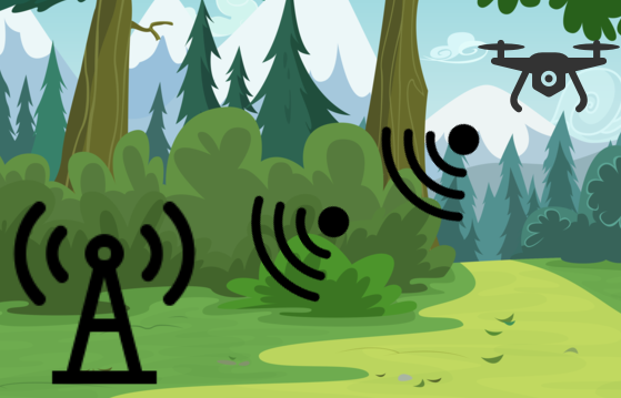
RTK, or Real-Time Kinematic, is a modern technology that allows measurements to be made with an accuracy of 1 cm of horizontal error under ideal conditions. It is used in industry, science and for commercial purposes. In this section of our store you can buy drones equipped with the RTK system, which will facilitate the daily work of specialists from many industries. We encourage you to familiarize yourself with their offer.
Why choose a drone with an RTK system ?
RTK, or Real-Time Kinematic, is currently a modern technology that uses measurements to achieve a horizontal error of up to 1 cm under ideal conditions. These measurements are obtained in real time, without making post-measurement calculations by applying corrections to the data sent from the satellite navigation.
RTK Drone – Improvement of Working Conditions
After buying a drone from RTK, the quality of work is much greater. The drone is a flying tool that will facilitate measurements. The systems are so accurate that there is no chance of confusion. GPS is accurate to 1 cm
Our RTK Drones
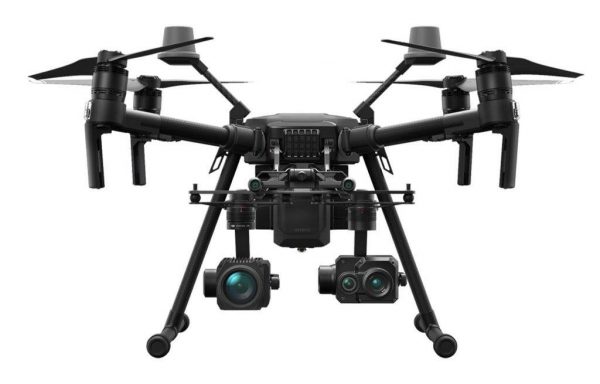
Our catalog includes 2 drones with RTK Systems. These are the best quality drones with very accurate systems that are reliable. Our experts verify a given model and then check its capabilities. Our catalog is full of various drones but RTK models are top models with the best components and of course the highest price
What measurements can be made with an RTK drone?
The use of precise measurements from the air allows us to prepare a number of specialist studies:
• ORTHOPHOTOMAPES. These types of studies have a wide range of applications – from maps for design and planning purposes, through plans for holiday resorts and shopping complexes, to the determination of the state of use, measurement of agricultural areas or documentation of natural disasters.
• NUMERICAL MODELS OF THE AREA, on the basis of which it is possible to very quickly and precisely calculate the volume of earth masses, changes taking place in workings and on heaps of opencast mines, or to analyze the progress of cliff erosion or other natural phenomena. Terrain models together with an orthophotomap are also used by archaeologists to select the places of future archaeological sites.
• PHOTO REPORTS – inventorying construction stages – the bane of today’s road, railway and cubature construction is the correct assessment of the work progress. Using the UAS system – drone measurements and advanced calculation methods, you can create monthly reports that document the works performed in a very precise and unquestionable way, allow you to calculate earthworks and provide the exact amount of loose materials collected on the construction site. Printing such a study in color with the applied CAD type design also allows for an ongoing analysis of the compliance of the work with the design assumptions.
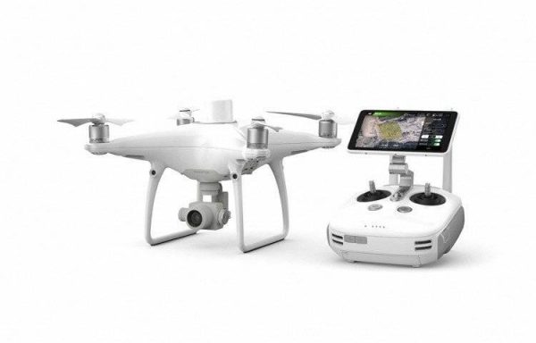
DJI – D-RTK 2 High Precision GNSS Mobile Station What is it?
Precise D-RTK mobile GNSS station 2
Optimized accuracy. Ultimate reliability
The D-RTK 2 is an enhanced high-precision GNSS receiver that supports all of the world’s leading satellite navigation systems, providing real-time differential correction data. With this data, the Phantom 4 RTK can generate position data with centimeter accuracy.
Position data accurate to the centimeter
D-RTK 2 supports GPS, GLONASS, Beidou and GALLILEO signals. Preparing the station is easy and quick. D-RTK 2 provides the drone with real-time differential data, enabling the drone to collect position data with centimeter accuracy. The built-in high gain antenna allows better satellite reception even without direct visibility.
A stable connection for every mission
The D-RTK2 supports 4G, OcuSync, WiFi and LAN connections, and ensures uninterrupted and stable connectivity in any application. Up to 5 controllers can be connected to the station at the same time. * This allows you to perform coordinated operations with multiple drones simultaneously, which greatly improves your work efficiency.
Powerful immunity
The IP65 protection rating and lightweight carbon fiber construction make the D-RTK2 an easy-to-carry tool that can handle any demanding task. Built-in IMUs detect movements and calibrate the tilt sensors so they can notify you of any abnormalities in time and reduce risk.
Comprehensive solutions
The D-RTK 2 mobile station is compatible with the Phantom 4 RTK and MG-1P RTK drones. The station can be used as a CORS benchmark that provides location data within range, making it an ideal tool for use in surveying, aerial inspection, agriculture, and other industries.